 |
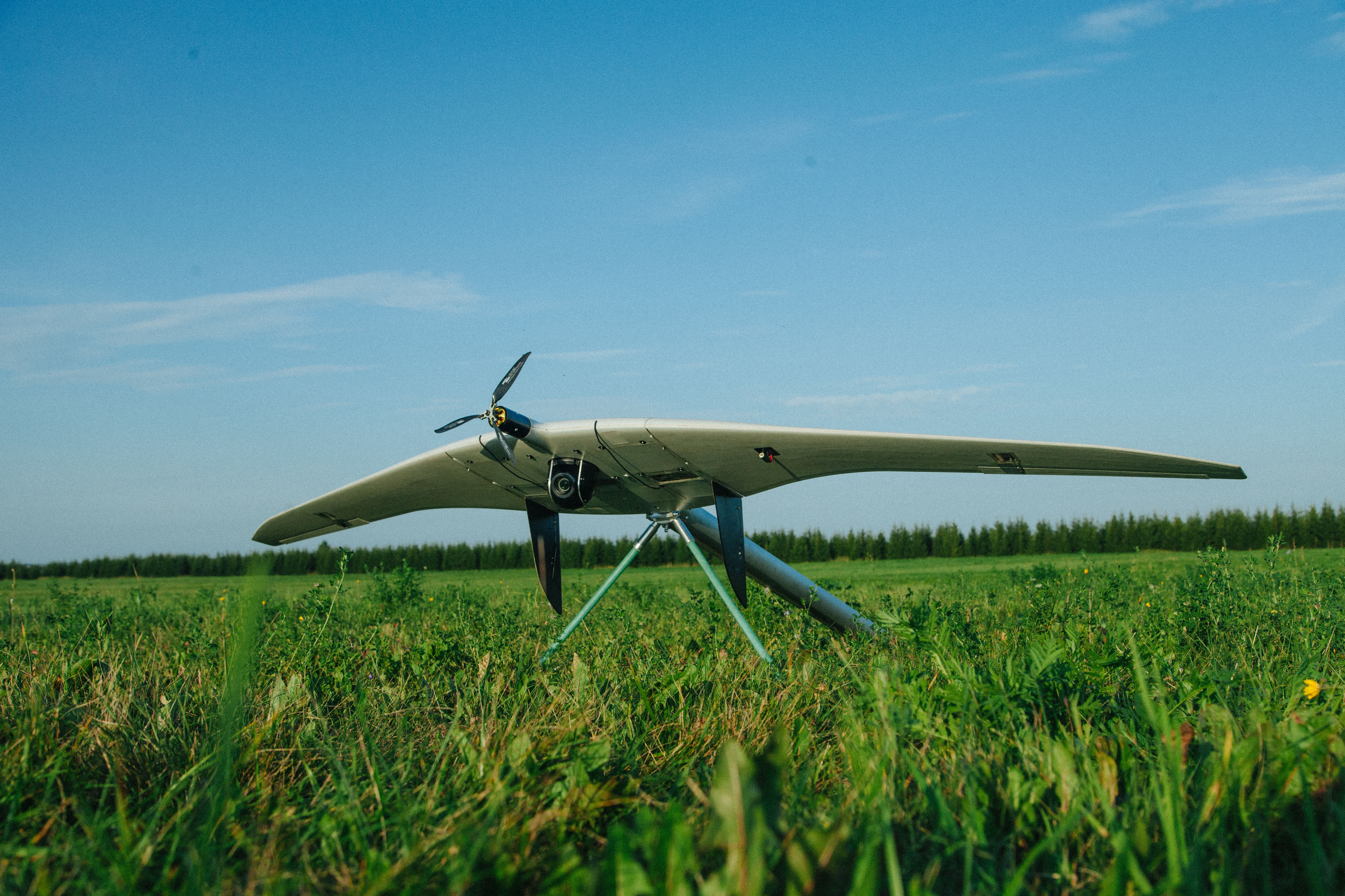
Supercam S350
The Supercam S350 is one of the flagship unmanned aircraft systems designed for aerial photography and video monitoring. The flight duration of up to 4.5 hours with data transmission range of up to 100 km provides the possibility of using the UAV in surveillance and reconnaissance missions, for protecting state borders, monitoring fuel and energy facilities, crisis management, as well as for other civil applications.
Part number:
Supplier:
Finco LLCDescription
Wingspan - 3.2 m
Endurance - up to 4.5 hours
Speed - 65 - 120 km/h
Radio link range - 70-90 km
Video transmission range - up to 50-100 km
Max flight range - 240 km
Max takeoff weight - 11.5 kg
Operational height - 150 ÷ 3000 m
Deployment time - 15 min
Takeoff - elastic catapult / pneumatic catapult
Landing - parachute with cords release system
Flight modes - automatic or semi-automatic
Diagnostics - automatic self-diagnostics of the ground and onboard equipment
Payload options:
- 20/24/42/60 MP photo camera with the ability to be mounted on the azimuth stabilized platform
- Gyro-stabilized thermal imaging camera and/or PAL or HD video camera with 10/33х optical zoom, that can be combined together, and optionally enhanced with a laser target marker
- Multispectral camera
- Airborne radiation sensor
- Laser gas analyzer
- Laser scanner
Optional equipment:
- Automatic target tracking module
- Dual (triple) system, dual-frequency geodetic receiver
- Video link for digital broadband transmission within a range of up to 50-100 km
- Radio link of telemetry and control with the ability of FHSS operation